Parched
Outback South Australia 2020
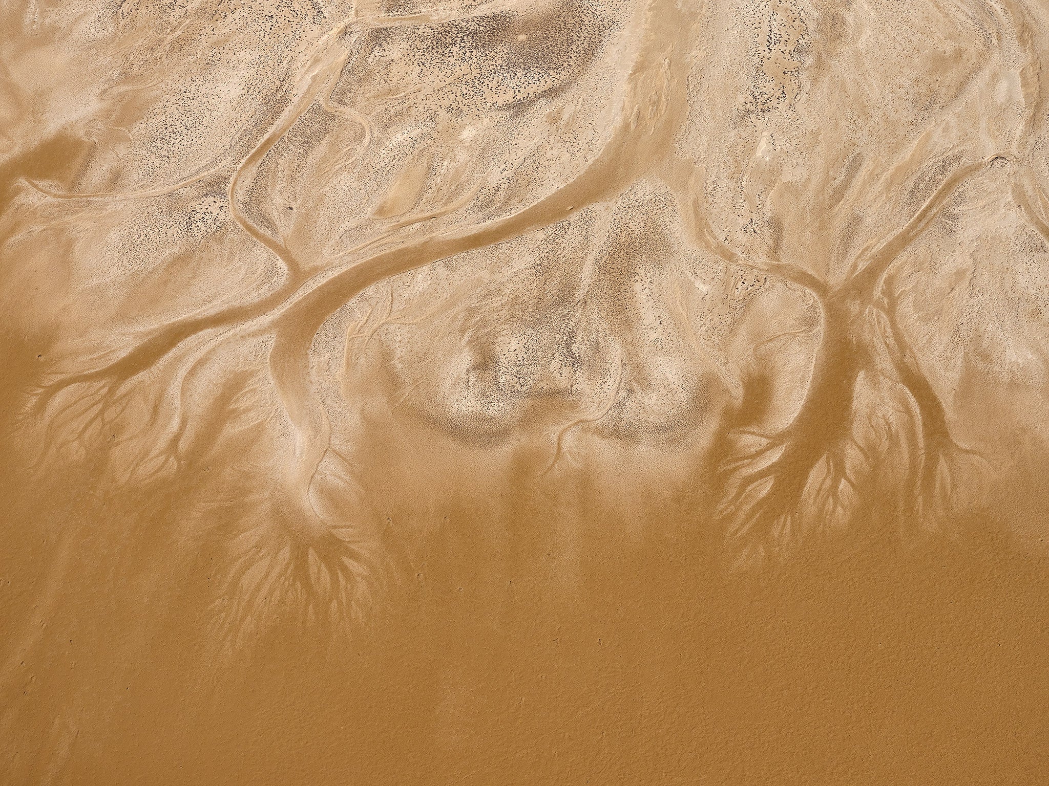
This series captures the intricate beauty of both Kati Thanda-Lake Eyre and Munga-Thirri-Simpson Desert National Parks. This was my first experience of aerial photography and it took no time for my addiction to take hold. Soaring above The abstract details of Kati Thanda and the expansive sand formations of Munga-Thirri, was nothing but extraordinary and my plans to return were already in motion before I returned home. Both areas at the time of visiting were bone dry.
Kati Thanda-Lake Eyre has a vast catchment area, encompassing from three states and the Northern Territory, and is actually comprised of two lakes. The north lake is 8,430 square-kilometres and at 15.2 metres below sea level, it is the lowest point in Australia. The south lake is 1,260 square kilometres. Together, they form one of the world’s largest salt lakes, carrying approximately 400 million tonnes of salt. Flood waters partially cover the lake once every eight years on average, however, the lake has only filled to capacity three times in the last 160 years.
Located within the driest region of the Australia continent, the Munga-Thirri – Simpson Desert National Park is one of the world’s best examples of Erg desert, also known as a “Sand Sea.” It is formed of a series of static parallel dunes running north-south and is a truly humbling sight. Varying in heights, the dunes range from 3 metres to 40 metres. At 3.6 million hectares, this forms Australia’s largest national park.


